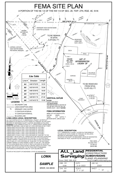
LOMA
A Letter of Map Amendment (LOMA)
A LOMA as defined by FEMA is: “A Letter of Map Amendment (LOMA) is an official amendment, by letter, to an effective National Flood Insurance Program (NFIP) map. A LOMA establishes a property's location in relation to the Special Flood Hazard Area (SFHA). LOMAs are usually issued because a property has been inadvertently mapped as being in the floodplain but is actually on natural high ground above the base flood elevation.”
When a LOMA is possible All Land Surveying recommends you go through with a formal application for removing a portion of the property from the Special Flood Hazard Area, removing your requirement to have Flood Insurance & making it an optional decision.
In addition to a LOMA application which is related to a portion of Land which your structure generally would be built upon. Sometimes a building may be located upon posts, piers or may be artificially built up with fill which will could also justify removal from the Special Flood Hazard Area through LOMR-F application